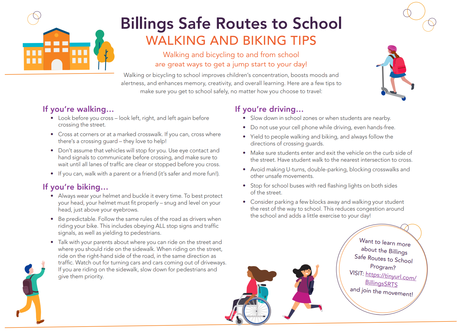
To participate in the survey for the Safe Routes to School Education Campaign, click here!
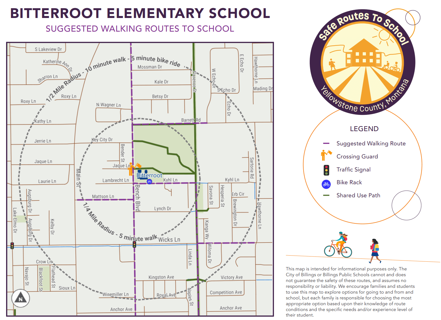
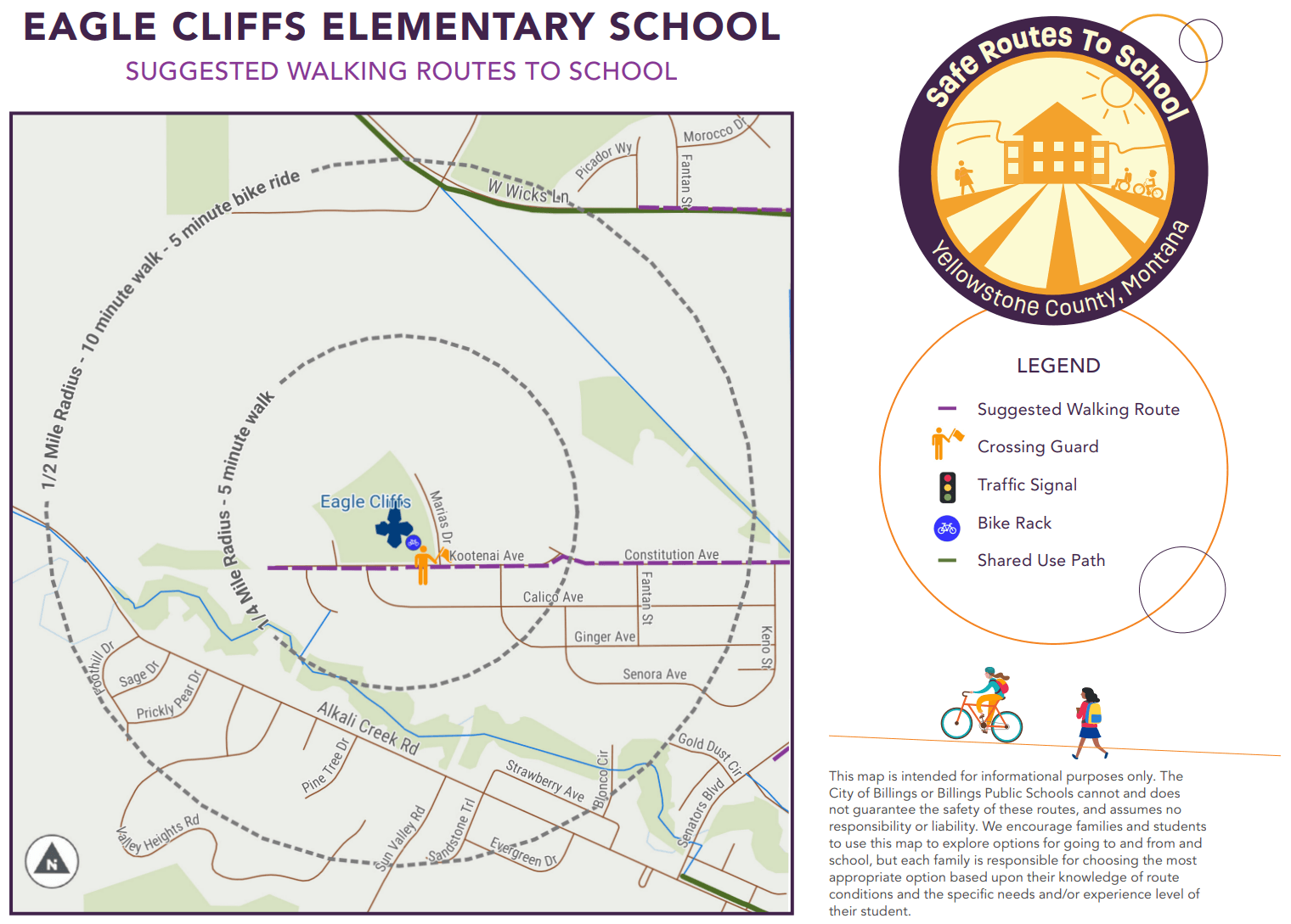
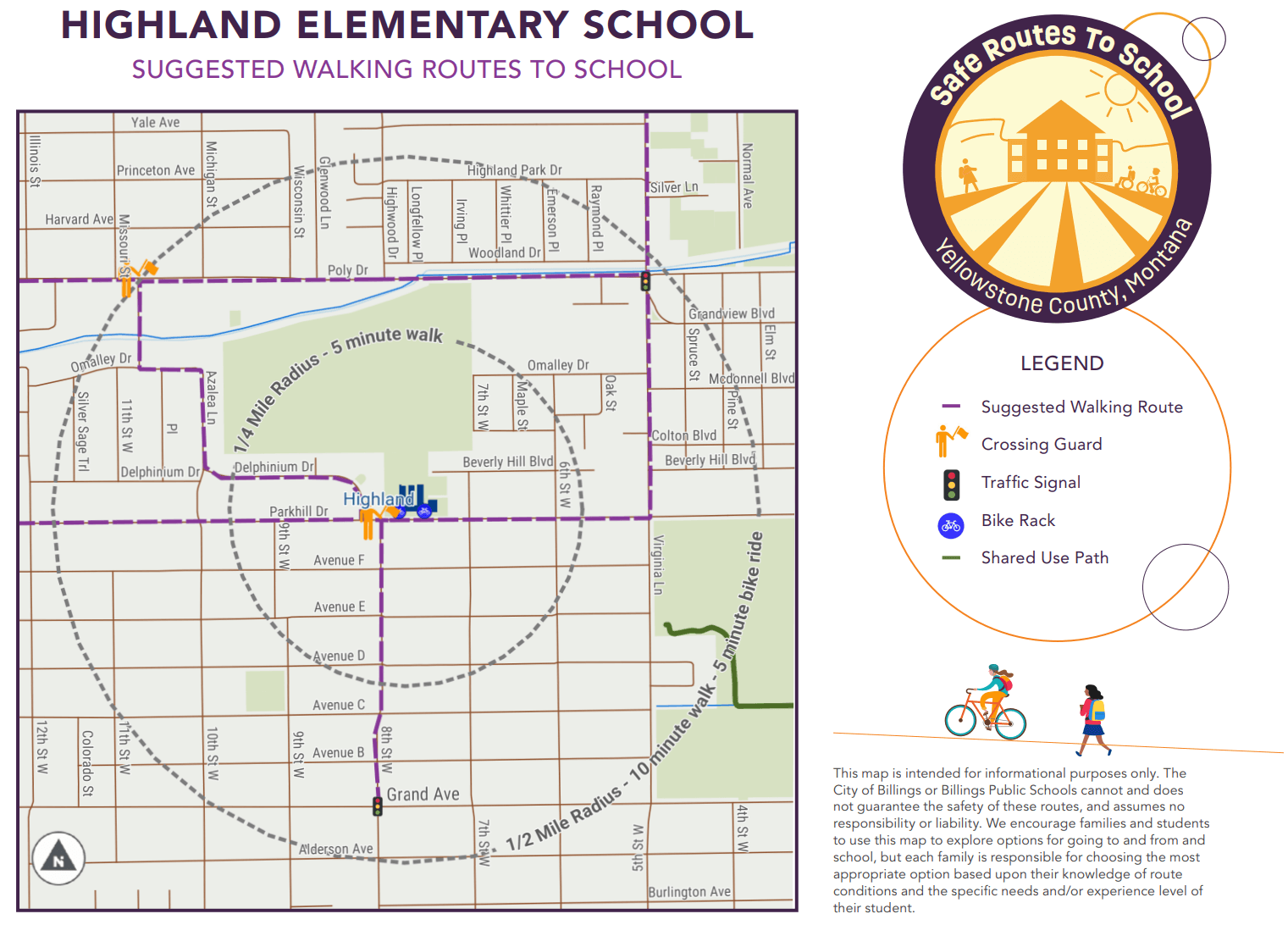
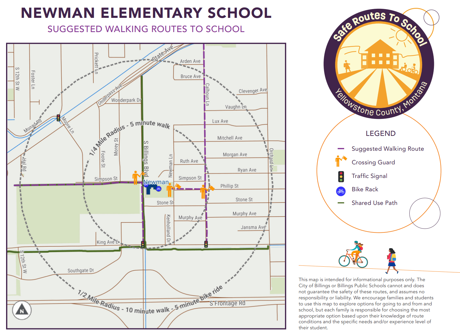
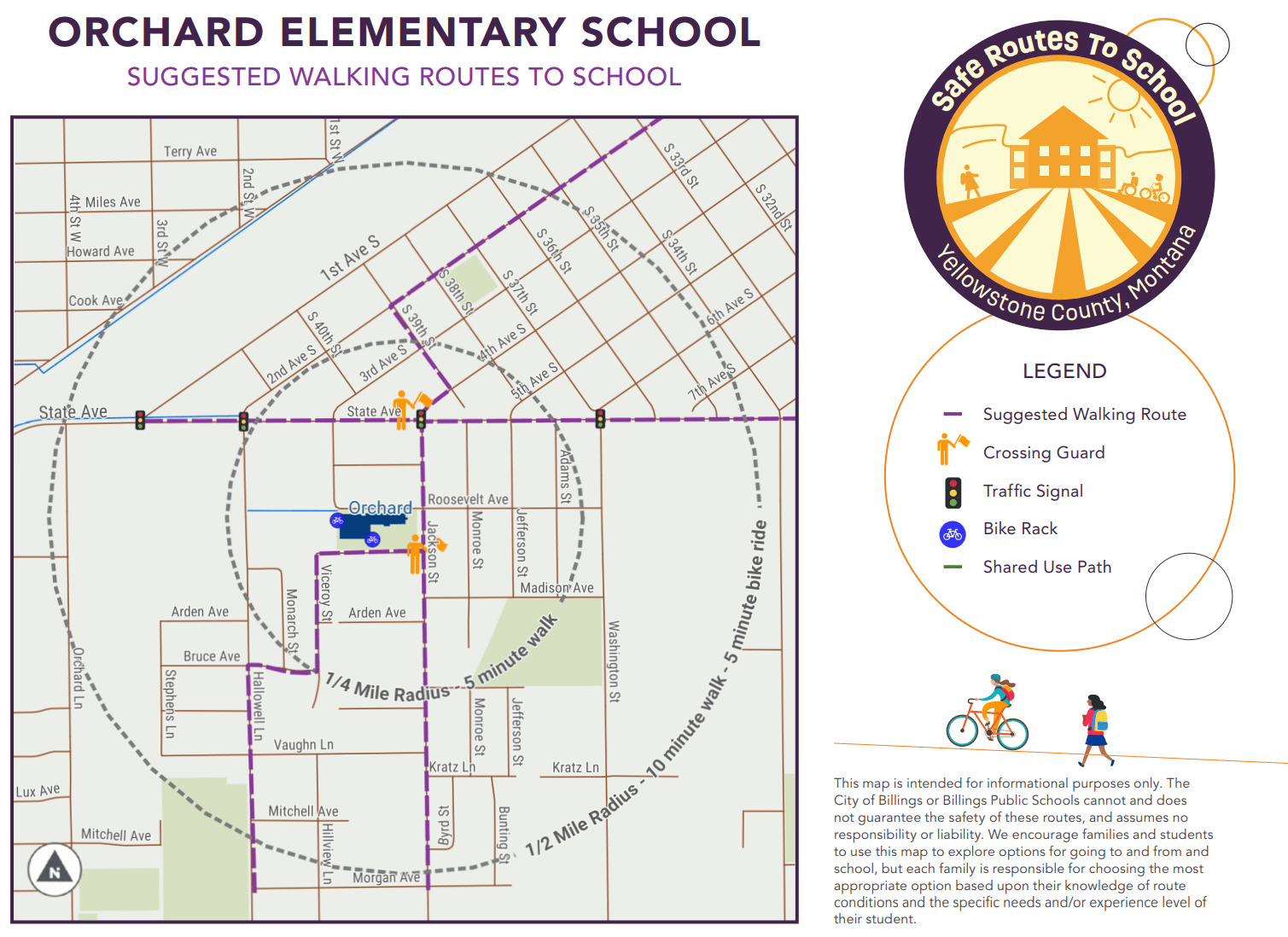
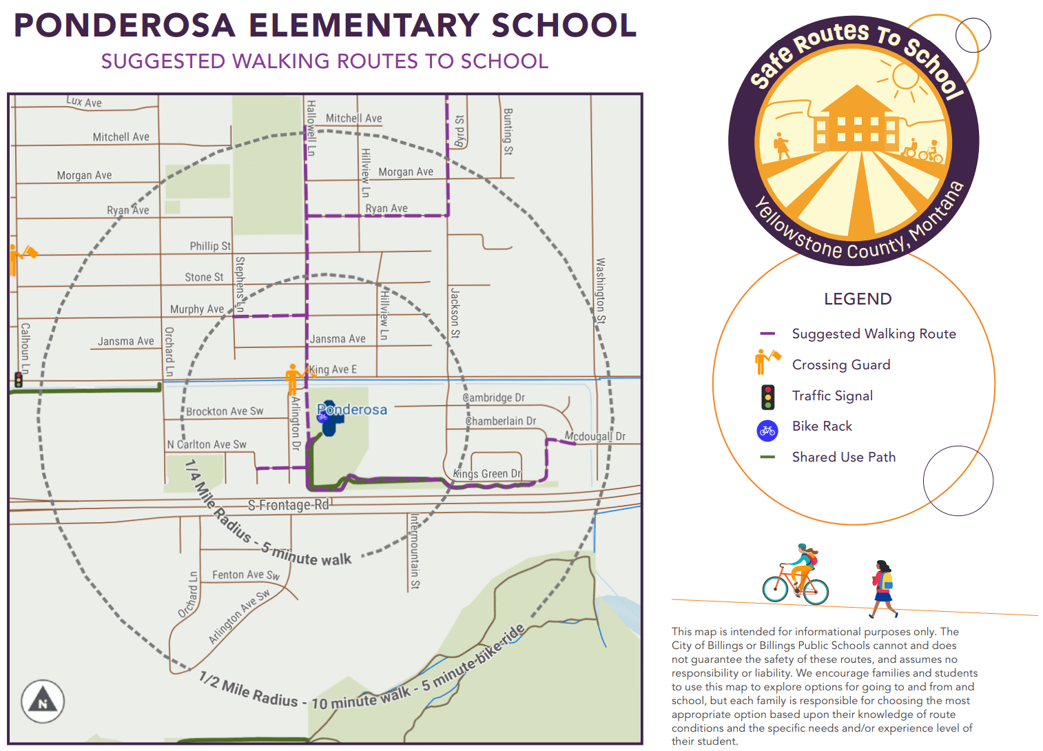
The walking route maps below were created through the Safe Routes to School Plan Update in 2022. A map was created for each of the 22 elementary schools in Billings.
Please note, this information is provided for informational purposes only. Street, traffic control devices, and route conditions are subject to change. The City of Billings or Billings Public Schools cannot and does not guarantee the safety of these routes, and assumes no responsibility or liability. We encourage families and students to use this map to explore options for going to and from and school, but each family is responsible for choosing the most appropriate option based upon their knowledge of route conditions and the specific needs and/or experience level of their student. Please continually review your selected route.
